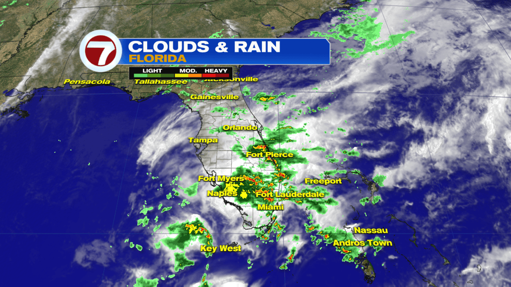
We’ve had back-to-back days with very wet and unsettled weather across Florida.
What’s the reason for all of the downpours? It can be traced to a disturbance that’s high in the sky and still lurking.
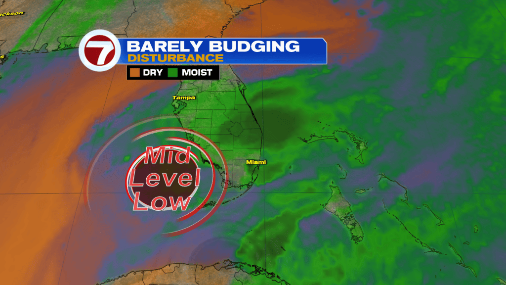
A “slow low” (broad Low Pressure area) continues to linger and it has had a lot of moisture to work with. The deep fetch of moisture is represented, above, in green.
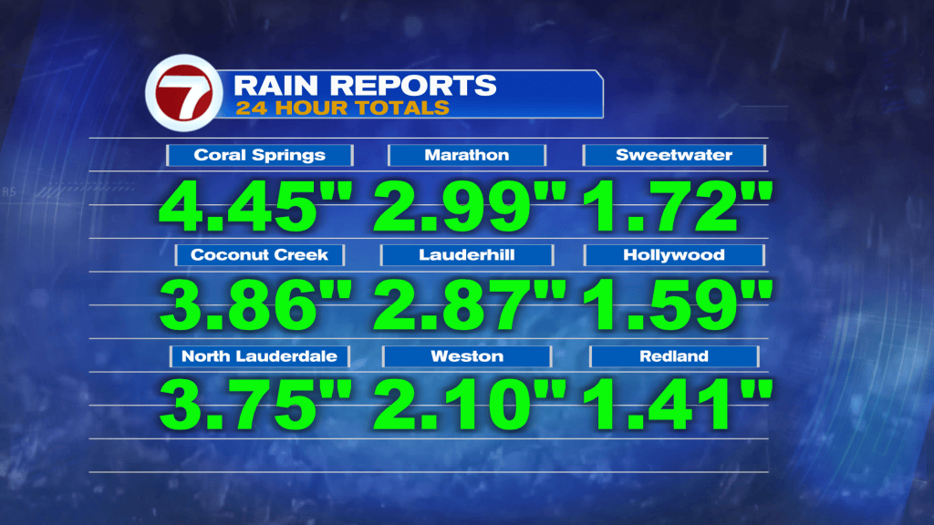
These high rain tallies, just in the past 24 hours, have resulted in many cases of flooding. Numerous advisories have been issued across Broward and Miami-Dade locations. The Florida Keys also had multiple alerts (Monday morning).
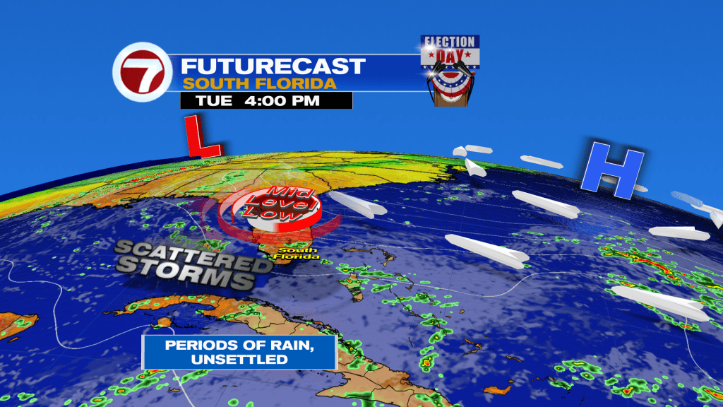
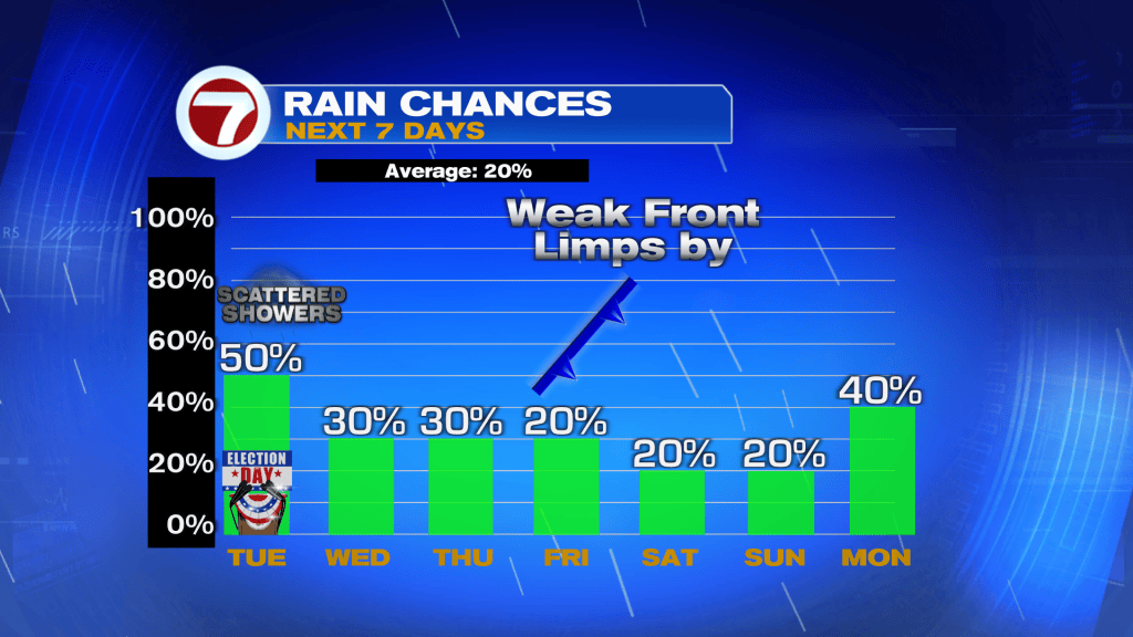
The forecast calls for more rainy effects on Election Day, but not as widespread. We’ll need to watch for at least scattered rain bands pulled along the breeze. So, when will it end? The Low Pressure is likely to drift eastward into Wednesday. That’s when we should get better, not wetter, conditions. Then, we’ll wait for a late week Front before the weekend. It may stall near us, but not immediately with much rain.